The shape of the housing stock in this valley is not accidental. It follows, in order, from where water surfaced, where a railway decided to stop, how the surrounding land was held, and what kind of house the country was building in each decade that the valley grew.
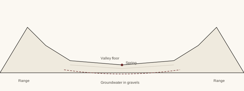
A valley with springs
The valley floor sits inside a ring of ranges, collecting what little water the mountains shed and holding it in gravels beneath the surface. In a few places that water reached the surface as springs, and those places were the reason anyone stopped here at all: first as a watering point on a long crossing, later as a small area of irrigated ground.
Everything afterwards is a story about extending that water supply outward, first from springs, then from wells drawing on the same gravels, and eventually from a distant river. Each extension changed what area could be built on, which is to say each extension changed the housing market.
The railway townsite
The decisive event in the valley's plan was the arrival of a railway and the laying out of a townsite next to it. A railway townsite is a specific kind of place: a rectangular grid surveyed in advance, blocks divided into standard lots, streets aligned to the track rather than to the landscape, and lots sold in a short burst of auctions.
That original grid remains the densest, most walkable and most finely divided part of the valley, because it was drawn before the car and its block size reflects a walking distance. Its lots are small, its streets meet frequently, and it has absorbed a century of individual rebuilding one parcel at a time, which is what a fine grid allows.
The land pattern around it
Beyond the townsite, most of the surrounding land was federally held and remains so. This is the single largest structural difference between this valley and a typical American metropolitan area, where the urban edge meets private farmland that can be sold and subdivided incrementally.
Here, land enters private hands through a deliberate process of disposal rather than through a thousand private decisions. The consequence is an edge that is administratively rather than economically determined, and a supply of new land that arrives in discrete quantities at moments chosen by policy.
Post-war subdivision
The valley grew fastest in the decades when the country built ranch houses on generous lots: single storey, low pitched roofs, attached garage facing the street, plan spread horizontally because land was the cheap input. Whole neighbourhoods were built in one campaign by one builder to a handful of plans, which is why they age as a cohort.
Later decades brought two storeys, tighter lots, taller walls to the street, and eventually the master planned community, which arrived with its own street hierarchy, its own recorded rules and its own internal centres. Each layer is visible from the road, and each has a characteristic set of maintenance questions that arrive at a predictable age.
Reading the valley from a car
Once the sequence is known, the valley reads legibly. Street width, block length, garage position, roof pitch, wall height at the footpath and the presence or absence of street trees together place a neighbourhood within a decade or two, and the placement predicts far more than the architecture: lot size, likely construction type, the age of the systems inside, and the kind of association rules, if any, that run with the land.